Stunning finale to the "National 3 peaks over 4 years" saga. After accident, illness, and breeding, we finally managed to get organised to climb Scafell Pike. Only somehow it had got to be November.
Original plan was to make an early start on the Friday, climb the hill, have an overnighter and a slow day on Saturday, and be back early. Weather intervened, and we made Friday a travel day instead.
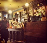
We spent the afternoon poking around gear shops in Keswick, and enjoying coffee, cake, and Led Zeppelin in the Square Orange coffee shop.
Original plan was to make an early start on the Friday, climb the hill, have an overnighter and a slow day on Saturday, and be back early. Weather intervened, and we made Friday a travel day instead.
We spent the afternoon poking around gear shops in Keswick, and enjoying coffee, cake, and Led Zeppelin in the Square Orange coffee shop.
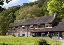
Night fell and on to our planned overnight stop. Borrowdale Youth Hostel offered us a double room for about £25 as non members. It was warm, cosy, there was a bar with excellent beer on tap, a games room, full English breakfast for £5, and no coach parties of teenagers. Full of friendly genuine outdoors types. Can't fault it. Will stay again.
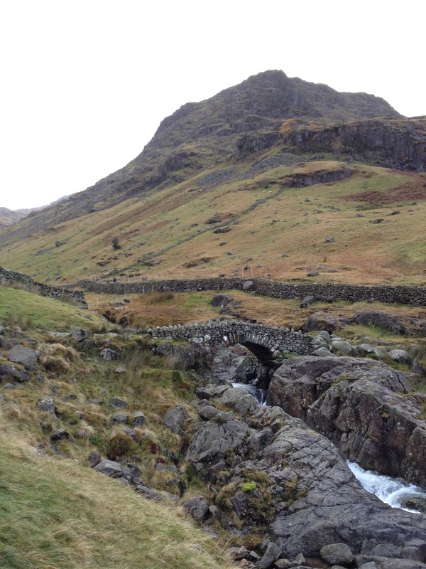
Rested, fed, and thankfully avoiding a hangover, we headed down to the farm at Seathwaite. Plenty of free onroad parking here at 8am in November. Suspect it might be a different story on a sunny August weekend.
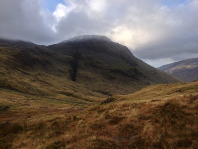
An obvious path lead up past the farm, and up towards the head of the valley.
An obvious path lead up past the farm, and up towards the head of the valley.
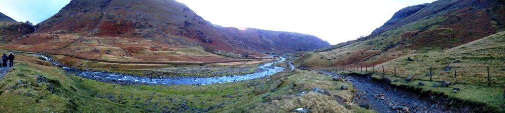
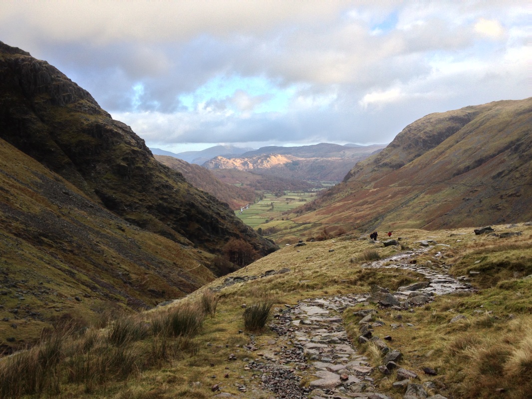
Route decision time at Stockley Bridge. The forecast on MWIS was marginal at best. The afternoon was likely to see hail, snow, possible thunder. However, it was only about 9am, and the waterfall looked nice, so "be rate, youth", and we set off up the Corridor Route instead of what we assumed to be the easier route up Esk Hause.
I've not given detailed directions here - if anyone wants to try this route, you'd be wise
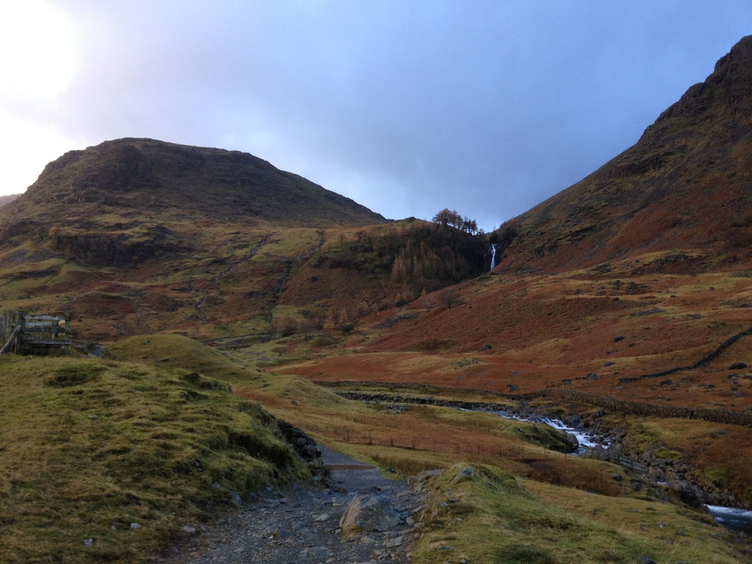
It was a steep pull up beside the waterfall, and in our first heavy shower of the day we toiled away inside waterproofs. The temperature was falling noticeably, as we reached the top and were exposed to the wind coming down the hanging valley of Styhead Gill.
I've not given detailed directions here - if anyone wants to try this route, you'd be wise
It was a steep pull up beside the waterfall, and in our first heavy shower of the day we toiled away inside waterproofs. The temperature was falling noticeably, as we reached the top and were exposed to the wind coming down the hanging valley of Styhead Gill.
The path up Styhead Gill ran close to the stream. So close, in fact that we were walking up the edge of the riverbed at one point. I slipped on some slime, and dropped my knee onto a rock. I was regretting bringing so much kit.
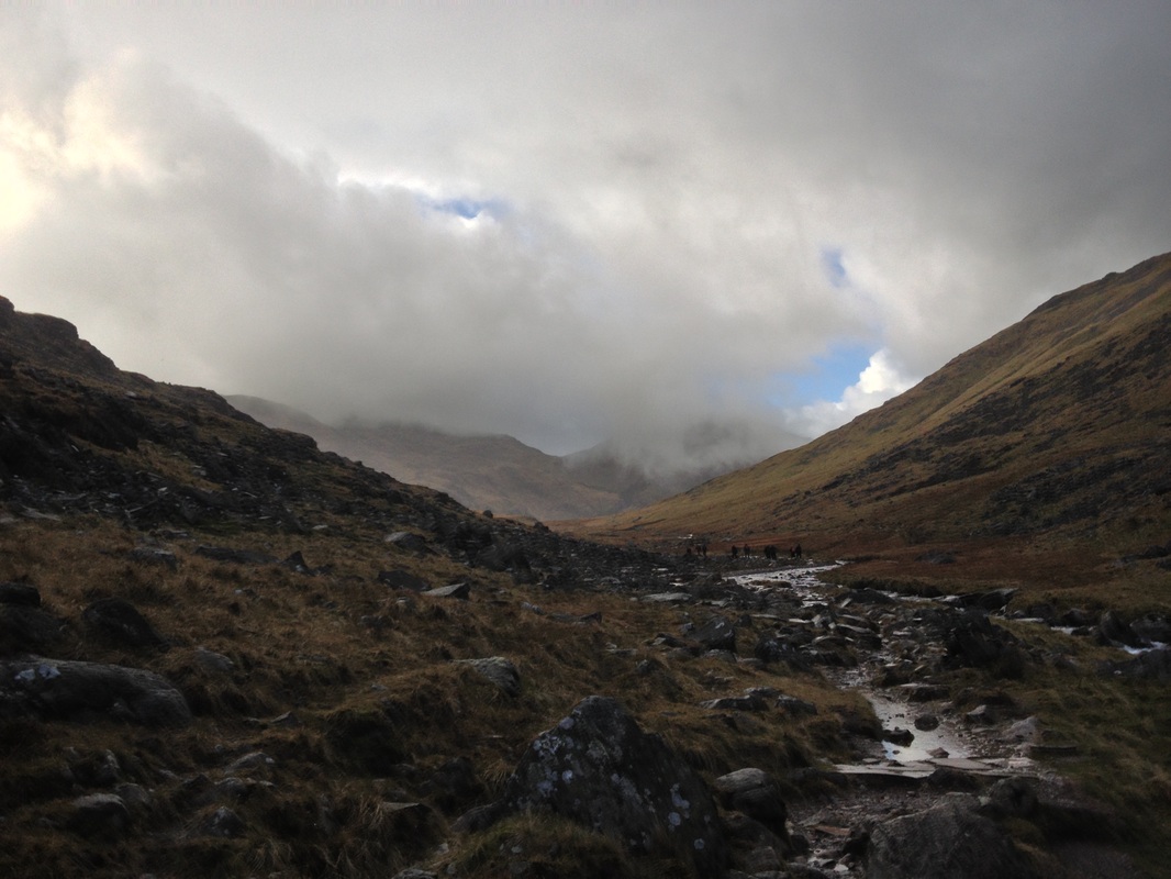
Eventually we reached Sty Head, and our go/no go decision. The weather had improved, and the view opened up to Lingmell and the "Crack of Doom" - Piers Gill. The highest peaks were still in cloud, but we decided to go for it.
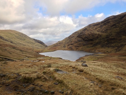
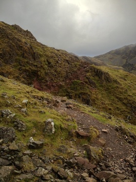
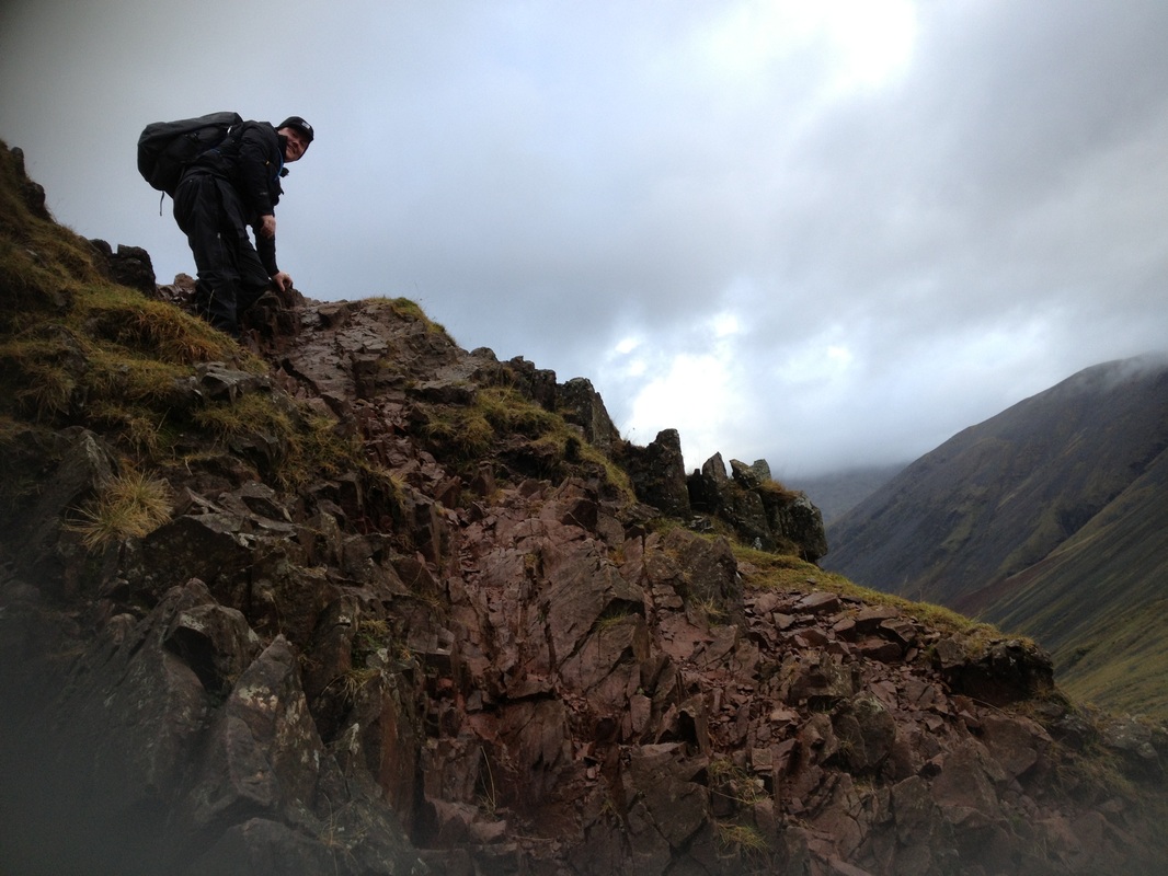
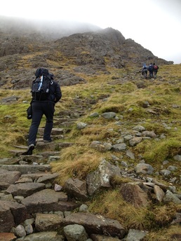
The Corridor route seemed to run on forever, weaving in and out between crags as streams cut into the rock. Things got progressively steeper and rougher, with a couple of easy scrambles, made harder by fatigue, damp conditions, and heavy packs.
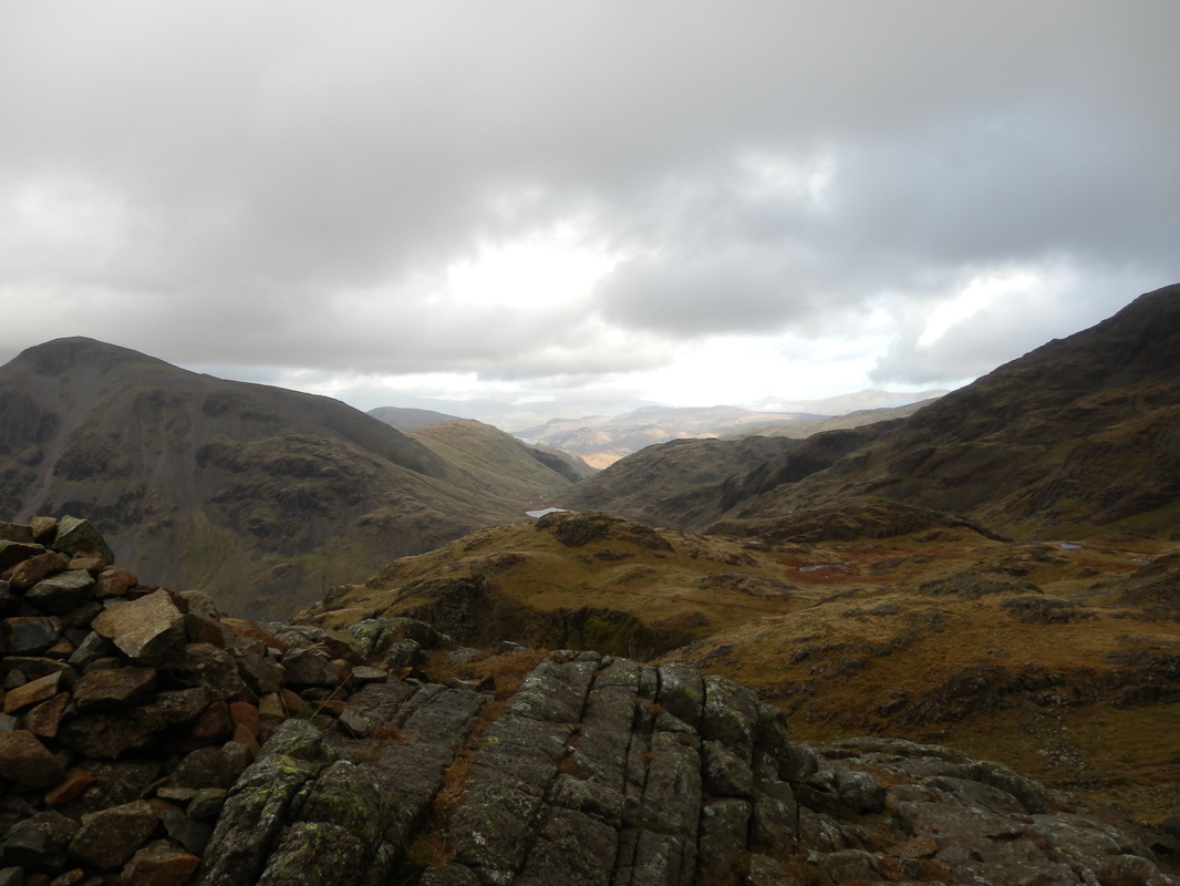

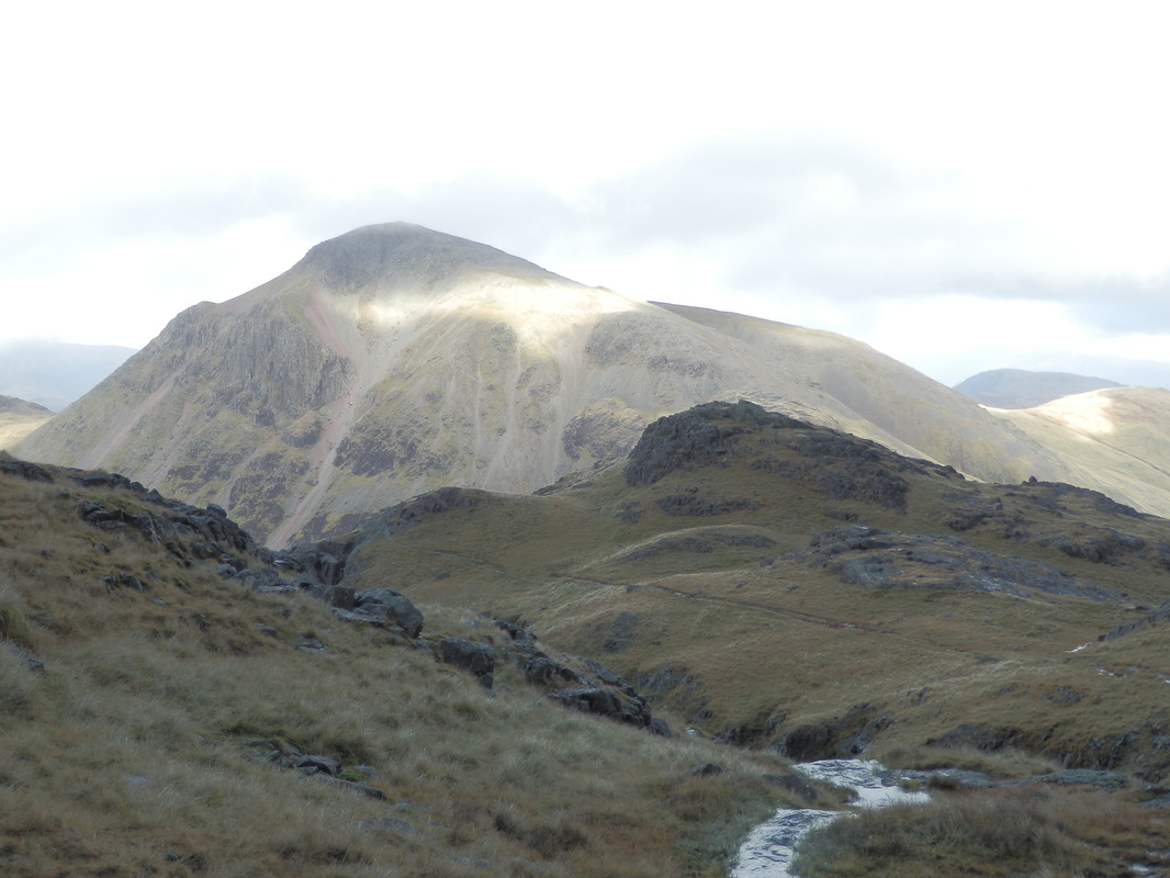
View over to Great Gable:
After the "bad step" above Piers Gill, the path pulls up towards the summit of Scafell Pike. Anyone planning to descend via the Corridor route should be careful because the path carries on down the ravine like a motorway, and you need to keep your eye out for an apparently blank section of rock on your right, with directions scrawled on using a softer stone like a chalk.
The walk had a real sting in the tail. Things were about to get steep, and bouldery. And at that point, the weather closed in, and my phone battery froze.
The walk had a real sting in the tail. Things were about to get steep, and bouldery. And at that point, the weather closed in, and my phone battery froze.
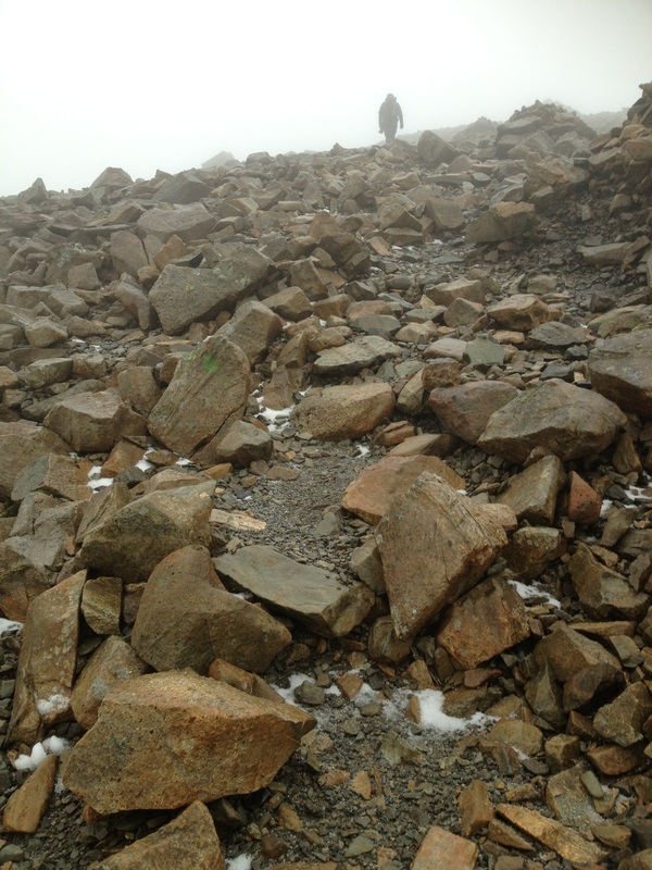
The weather deteriorated from wind and rain to hail to flurries of snow, then into a blizzard. We followed the path of cairns up to the summit. It took forever. Must have been a good 40 minutes on the loose boulders, complicated as the gaps filled with snow.
Eventually we topped out, and I climbed the summit cairn.
Eventually we topped out, and I climbed the summit cairn.
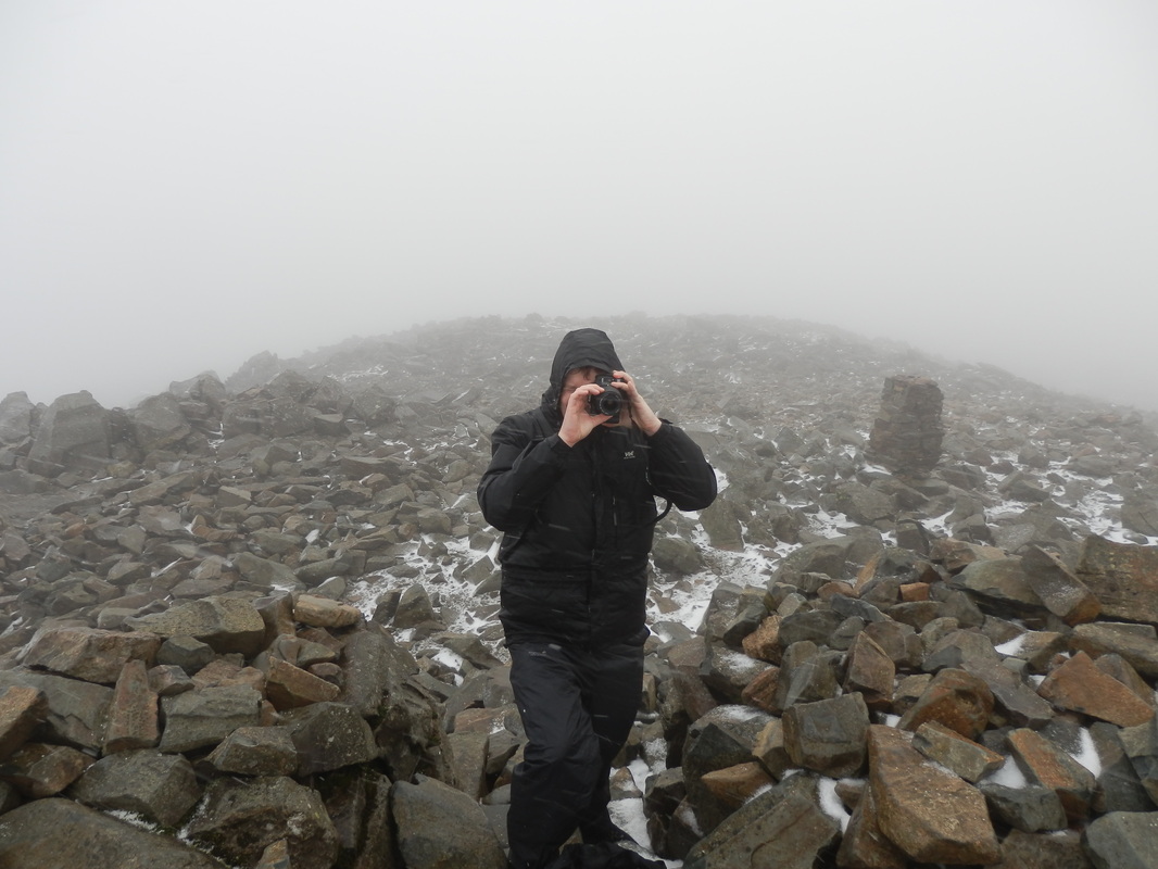
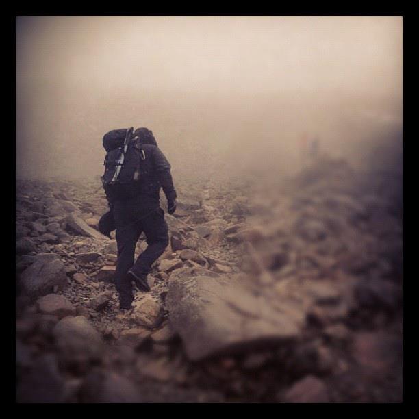
The photos stop there, as things continued to deteriorate, and the snowfall increased. I was considering taking my ice axe from my pack, as things became slippier with the snow building up underfoot, and the path steepened down the convex side of the mountain.
The boulder field was full of people asking directions. The cloud was well down, and there was snow flying everywhere in the strong wind. I had taken a compass bearing in the relative shelter of the side of the summit cairn, but was suffering from self doubt. I asked a few people who which route they had taken, and confirmed we were heading the right way. I couldn't face the corridor scrambles in the poor weather, so headed for Esk Hause.
What started as a relatively faint path soon became a wide motorway as we dropped to a col where a huge white demoralising mountain loomed into view. The first false summit, and then eventually up onto Ill Crag.
Ill Crag was bouldery, and difficult in the fresh snow. There were a few large groups of men with dogs heading the same way, and they felt the need to charge past, barging us off the line of the path, and then stopping, clogging the place up. Very irritating.
Eventually we reached a large cairn as we dropped down, and from the map I was pretty sure we needed to turn left (at Esk Hause). Thankfully they charged onwards, towards Esk Pike and Bow Fell. The cloud was still down, so I checked our position with the GPS on my Google Nexus tablet running a copy of Landranger. It was the only thing with any battery left.
Another comfort check at the top of Grains Gill, and we knew we were heading the right way.
GPS use in the hills is a contentious topic just now, but I think it's a great navigational aid, provided you're not entirely reliant upon it. Map and compass, with GPS for when you're struggling. And brilliant when you can't see your hand in front of your face in a white-out.
The snow had turned to rain by now, and we faced a dull wet downward trudge back to the car. We met walkers in shorts heading up the hill. It was about 2:30pm. Madness!
The paving stones which comprised the path sloped downhill steeply, and it was downright dangerous in the wet, with a steep drop on the left, and parts where the path had collapsed into Grains Gill due to erosion.
We were glad to get back to the car before dark. It had been an epic full day, Sadly we didn't make our planned snack stop at the http://www.llamakarmakafe.co.uk/ just outside Penrith. We'd seen it on the way up, but it was invisible heading back, and closed at 5pm anyway :(
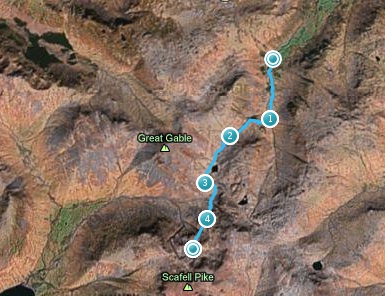
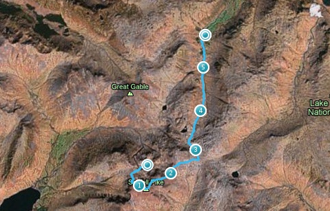
Two GPS traces because my phone died, then I found the GPS watch I thought I'd forgotten. For some reason I get an error when I try to stitch them together.
Anyway, that's the 3 peaks done. I don't think I'd do Scafell Pike again - the boulders were a nightmare! Some great views of Great Gable and back over Derwent Water to Keswick and Skiddaw / Blencathra on the way up, but with so many hills to choose from, I don't feel the need to go back.
The boulder field was full of people asking directions. The cloud was well down, and there was snow flying everywhere in the strong wind. I had taken a compass bearing in the relative shelter of the side of the summit cairn, but was suffering from self doubt. I asked a few people who which route they had taken, and confirmed we were heading the right way. I couldn't face the corridor scrambles in the poor weather, so headed for Esk Hause.
What started as a relatively faint path soon became a wide motorway as we dropped to a col where a huge white demoralising mountain loomed into view. The first false summit, and then eventually up onto Ill Crag.
Ill Crag was bouldery, and difficult in the fresh snow. There were a few large groups of men with dogs heading the same way, and they felt the need to charge past, barging us off the line of the path, and then stopping, clogging the place up. Very irritating.
Eventually we reached a large cairn as we dropped down, and from the map I was pretty sure we needed to turn left (at Esk Hause). Thankfully they charged onwards, towards Esk Pike and Bow Fell. The cloud was still down, so I checked our position with the GPS on my Google Nexus tablet running a copy of Landranger. It was the only thing with any battery left.
Another comfort check at the top of Grains Gill, and we knew we were heading the right way.
GPS use in the hills is a contentious topic just now, but I think it's a great navigational aid, provided you're not entirely reliant upon it. Map and compass, with GPS for when you're struggling. And brilliant when you can't see your hand in front of your face in a white-out.
The snow had turned to rain by now, and we faced a dull wet downward trudge back to the car. We met walkers in shorts heading up the hill. It was about 2:30pm. Madness!
The paving stones which comprised the path sloped downhill steeply, and it was downright dangerous in the wet, with a steep drop on the left, and parts where the path had collapsed into Grains Gill due to erosion.
We were glad to get back to the car before dark. It had been an epic full day, Sadly we didn't make our planned snack stop at the http://www.llamakarmakafe.co.uk/ just outside Penrith. We'd seen it on the way up, but it was invisible heading back, and closed at 5pm anyway :(
Two GPS traces because my phone died, then I found the GPS watch I thought I'd forgotten. For some reason I get an error when I try to stitch them together.
Anyway, that's the 3 peaks done. I don't think I'd do Scafell Pike again - the boulders were a nightmare! Some great views of Great Gable and back over Derwent Water to Keswick and Skiddaw / Blencathra on the way up, but with so many hills to choose from, I don't feel the need to go back.
 RSS Feed